Our expertise is driven by a passion for mapping and data analysis techniques,
and their power to reveal how the world is organized.
We offer consulting and business application development services
across the entire lifecycle of geographic information.
Our expertise
- Technical consulting
- Design of mapping tools
- Web, mobile, and software development
- QGIS plugin development
- Deployment & support
We work on all phases of a project (specifications, technical study, development, POC, deployment, maintenance and support), either independently or in collaboration with existing teams.
3 ways to support you
End-to-end application development and modular application components
Development of websites and cross-platform mobile applications (iOS, Android).
Business API design.
QGIS plugin development.
Deployment in your own infrastructure (On-Premise) or on a Cloud.
Data Engineering & Models
Design of data processing tools and workflows tailored to your business needs and performance goals.
Design and implementation of data models.
Project consulting
Defining technical and methodological strategy for your applications and data: technical studies, prototyping, benchmarking against market standards and best practice, optimisation…
Technical audits of applications: assessing quality and performance, reviewing development processes, identifying improvement opportunities, and building a roadmap…
Our technologies
We work with a wide range of technologies, with a strong preference for open source.
Our main technologies include:
Languages: Python, JavaScript, PHP, C/C++
Frontend: React, Vue.js
Backend: Django, FastAPI, Flask, Express.js
Mobile: React Native
Databases: PostgreSQL/PostGIS, MySQL, Oracle Spatial, MongoDB
Web Mapping: OpenLayers, MapLibre, Leaflet, Mapbox GL, Mviewer, CesiumJS, MapServer, GeoServer, pg_tileserv
End-to-End Solutions: Mviewer, GeoNature Suite
Libraries: GDAL/OGR, Shapely, RasterIO, NumPy, Pandas, Dask, NetworkX
Some references
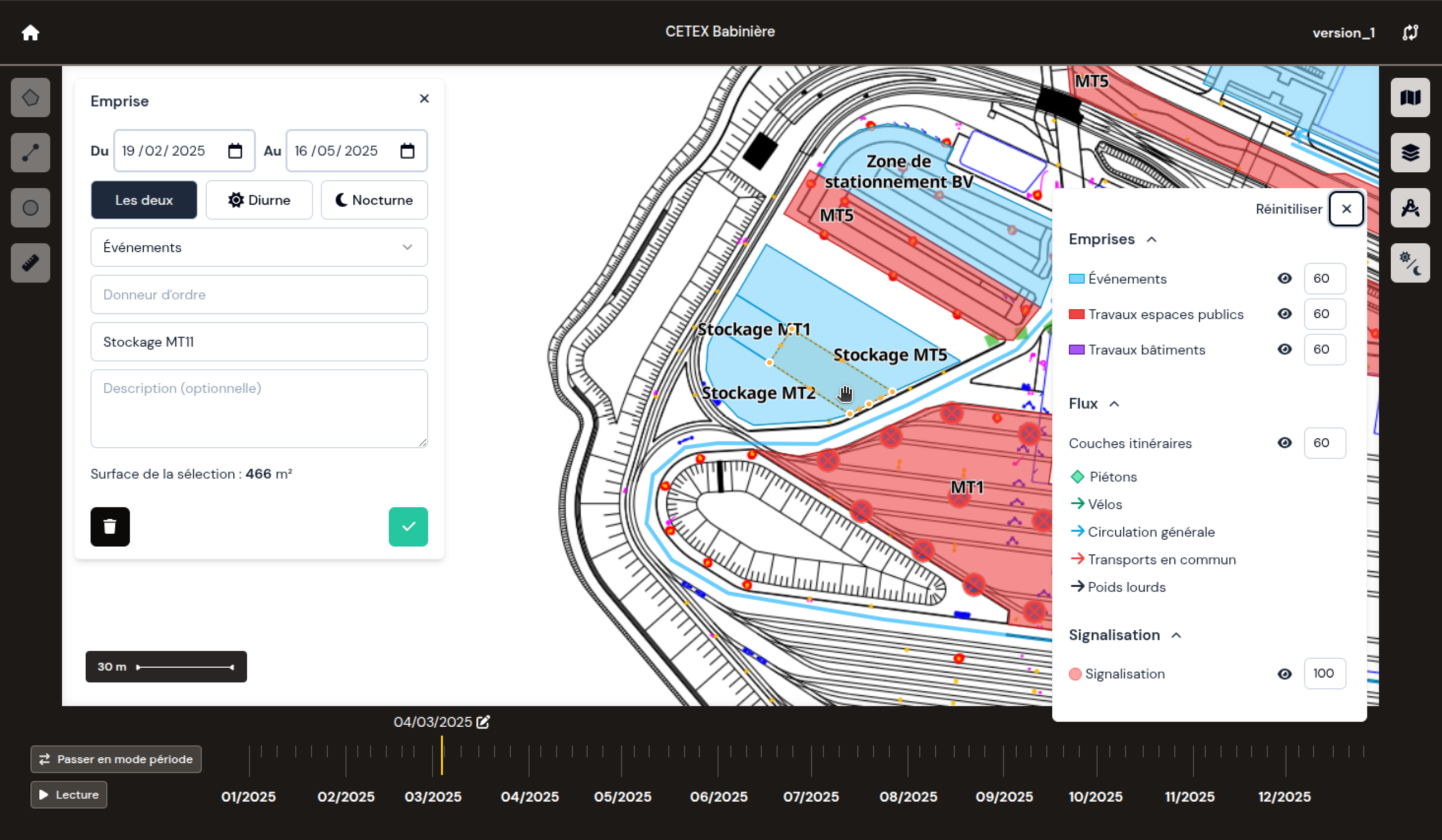
Gradial platform design
Design and development of the Gradial web application for construction-project monitoring, built for Adila to support transport and urban planning projects run by local and regional authorities.
The tool allows users to draw and track the different phases of large-scale infrastructure projects, using high-precision CAD basemaps, standard maps, or satellite imagery.
TropiSCO website design
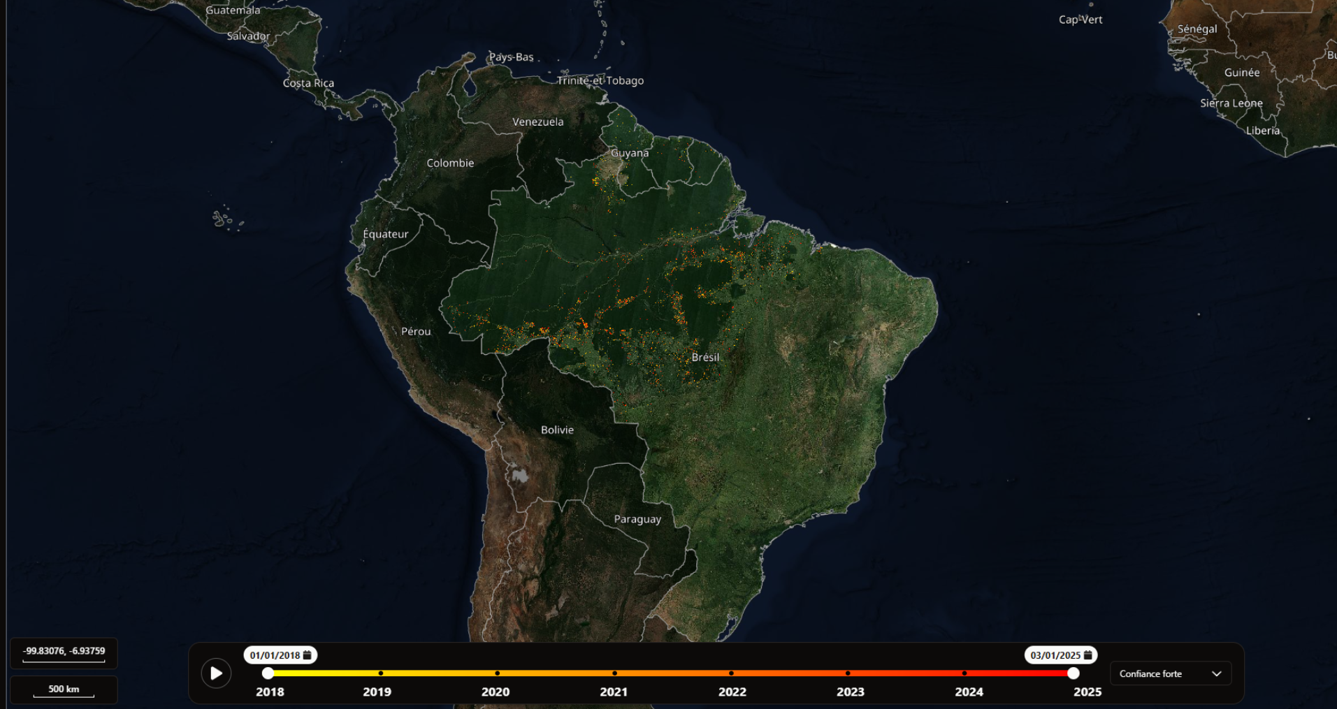
Development, for the French space agency CNES, of the TropiSCO website, a time-based mapping platform tracking deforestation across several tropical countries, updated weekly.
The website offers a timeline to explore data over time, a Player mode to visualise deforestation progression, and regional summaries.
To deliver smooth, high-performance map rendering, we used innovative techniques to colourise data directly in the browser, without server requests.
Consulting & support for web map production / Michelin
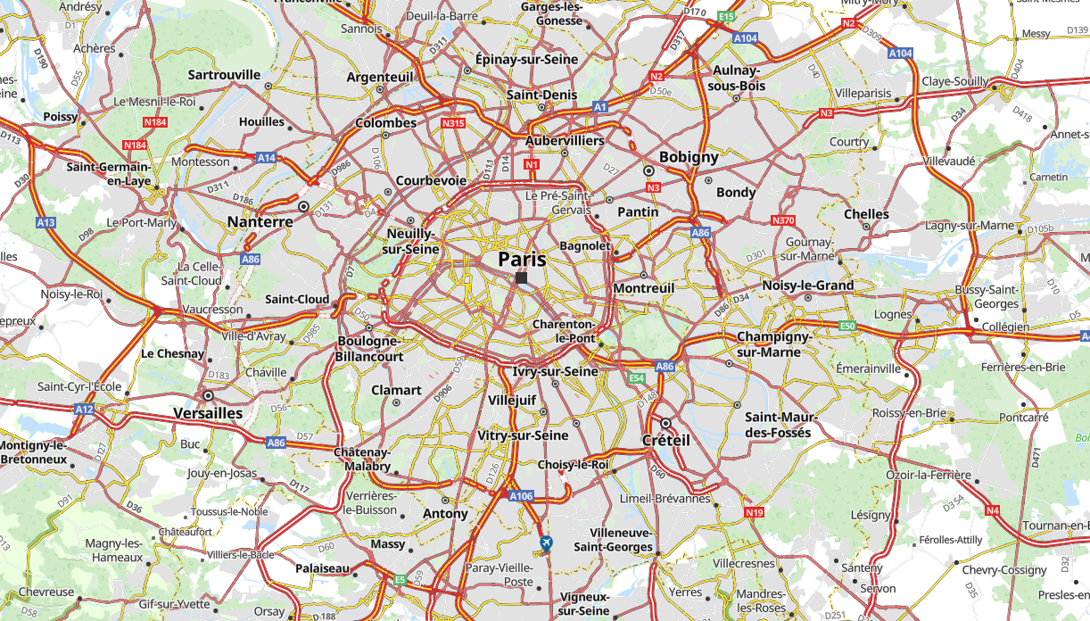
Consulting on the overhaul of the map-production pipeline for the ViaMichelin website.
Following an audit of the existing mapping production chain, the project optimised methods and automated processes to reduce production time. The engagement also delivered a methodology combining vector-based distribution for ViaMichelin with raster-based distribution for certain legacy platform.
Finally, we supported Michelin in developing the new production workflow: solution prototyping, and designing and improving SQL/Python processing algorithms.
Géofoncier mobile app design / Neogeo & Géofoncier
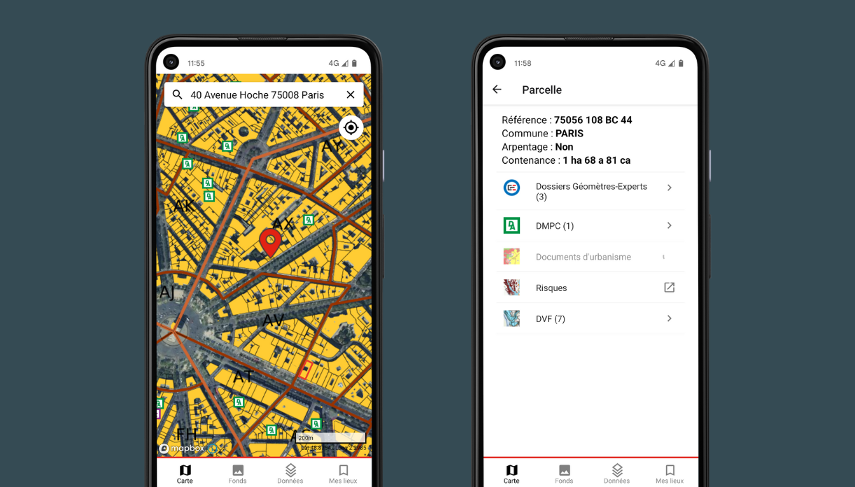
Development of the Géofoncier mobile app using React Native cross-platform technology and the Mapbox React Native mapping API.
Géofoncier Mobile is the mobile version of the Géofoncier land-data portal, launched by the French Order of Land Surveyors (Ordre des Géomètres-Experts).
Topographic data quality control
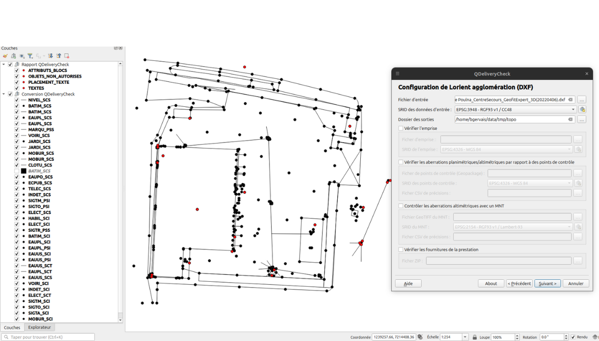
Since 2022, we have been supporting the Brittany and Pays de la Loire regions, four regional energy authorities in Brittany, and numerous local authorities with topographic data quality control.
The QGIS plugin we designed, along with its associated web platform, checks the data submitted by land surveyors, automatically generates an analysis report, and converts data into a standardised high-precision topographic format (PCRS).
This tool saves our clients significant time on data control, allows them to pool their quality-control processes, and raises data quality standards across all service providers.
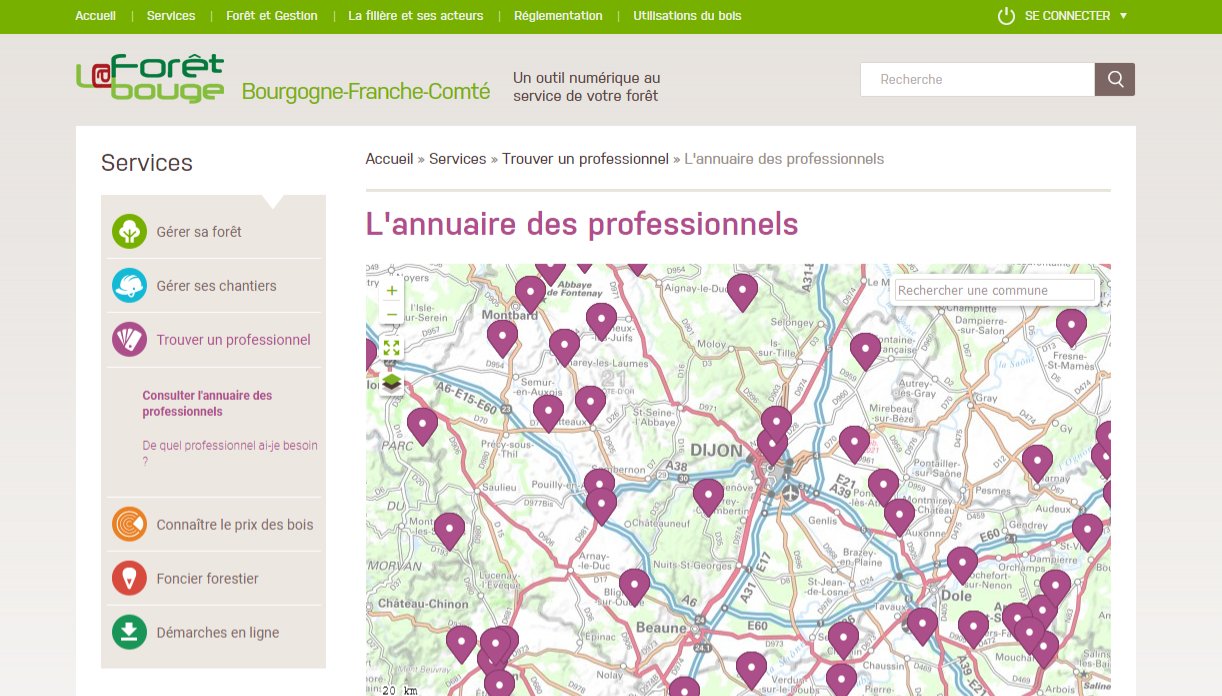
Mapping components for "La Forêt Bouge" website / CNPF & Softeam
Collaboration with Softeam on the redesign of the CNPF’s “La Forêt Bouge” forestry portal.
We designed all the mapping interfaces (frontend components) using a more modern technical, visual, and UX foundation.
This included topological editing features to simplify the creation of forest parcel boundaries for management planning purposes.
We also built several APIs for querying cadastral and base map data, with automated mechanisms to keep all data up to date.
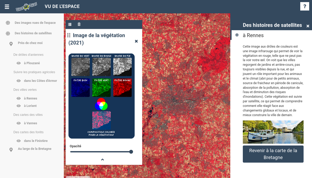
API Cadastral data query API / IMMUP
Designed a cadastral data query API to meet the prospecting requirements of real estate agents
The API offers multiple filtering options for cadastral parcels according to real estate prospecting requirements.
Highly efficient, it is used daily by several thousand users.
We developed various algorithmic processes to enrich the API with parcel-level information useful to the real estate sector, including building shapes.
GeoServer deployment, configuration & training / Le Mans Métropole
Supported Le Mans Métropole in deploying GeoServer and training its GIS team.
Delivered in partnership with IDGEO, the project included GeoServer / GeoWebCache training tailored to Le Mans Métropole’s data and data dissemination challenges, with a focus on performance and upstream data configuration.
It also covered the deployment of both solutions and their initial configuration, in coordination with the client’s IT department.
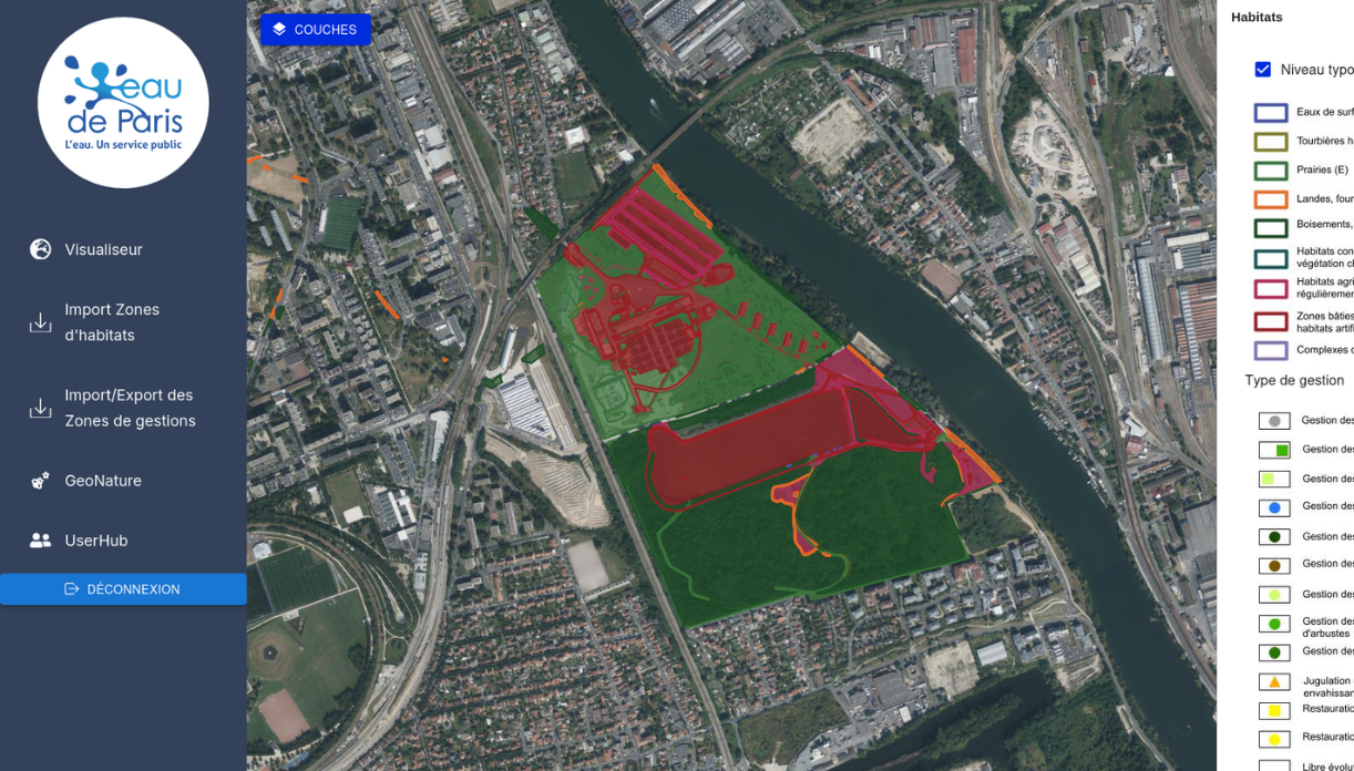
Designing tools to support Eau de Paris’s biodiversity protection efforts
Deployment of the GeoNature platform, and design of a module for visualising and editing ecological management plans.
Provided support for biodiversity data specifications and standardization, in partnership with Ecosphere, and developed a module linked to GeoNature.
The solution extends GeoNature with visualisation of: Ecological priorities, ecological management plans, habitat zones, protected areas.
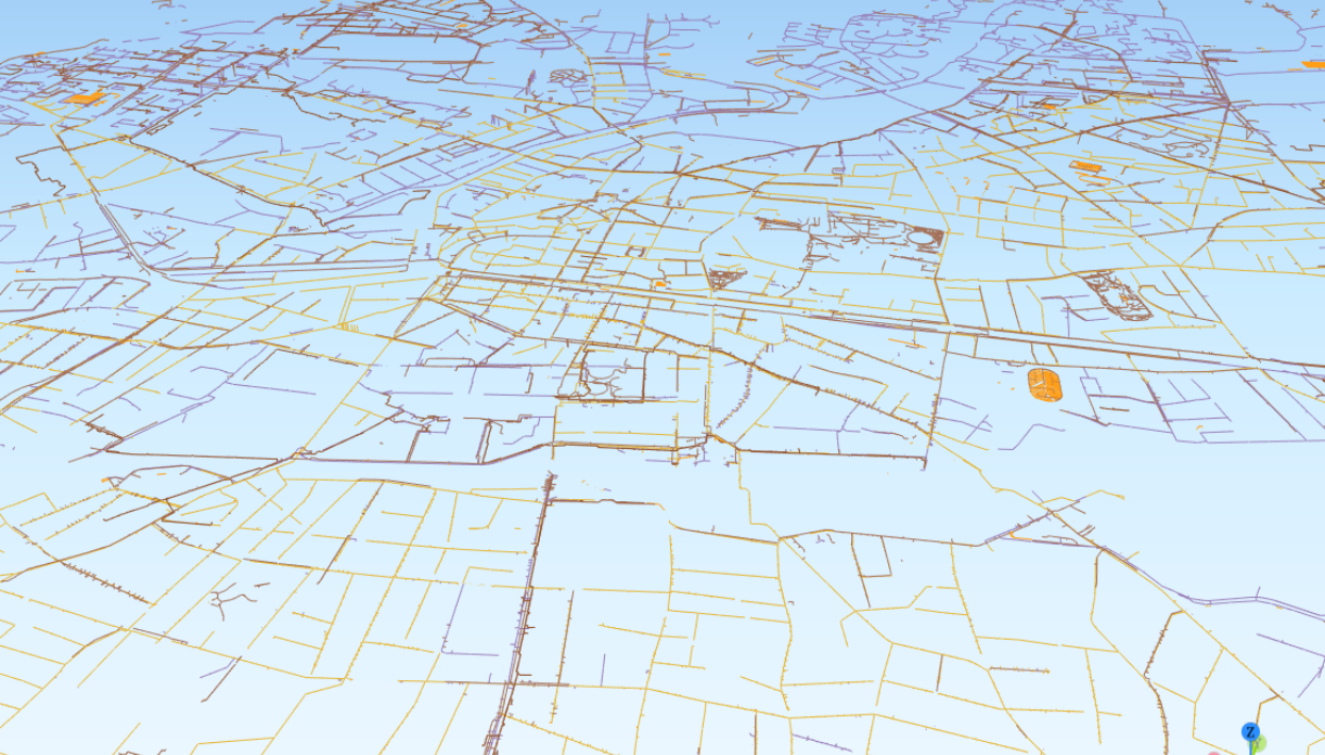
3D modelling study for Rennes Métropole's underground utility network data
Design of a data analysis and quality-control solution for underground utility networks, and generation of a 3D model.
The project explored various approaches to working with Rennes Métropole’s underground network data, and quickly focused on building data-control tools to flag errors or inconsistencies and support their correction.
Once validated, the data was processed to produce a 3D model usable in Cesium and QGIS.
Gradial platform design
Design and development of the Gradial web application for construction-project monitoring, built for Adila to support transport and urban planning projects run by local and regional authorities.
The tool allows users to draw and track the different phases of large-scale infrastructure projects, using high-precision CAD basemaps, standard maps, or satellite imagery.
TropiSCO website design
Development, for the French space agency CNES, of the TropiSCO website, a time-based mapping platform tracking deforestation across several tropical countries, updated weekly.
The website offers a timeline to explore data over time, a Player mode to visualise deforestation progression, and regional summaries.
To deliver smooth, high-performance map rendering, we used innovative techniques to colourise data directly in the browser, without server requests.
Consulting & support for web map production / Michelin
Consulting on the overhaul of the map-production pipeline for the ViaMichelin website.
Following an audit of the existing mapping production chain, the project optimised methods and automated processes to reduce production time. The engagement also delivered a methodology combining vector-based distribution for ViaMichelin with raster-based distribution for certain legacy platform.
Finally, we supported Michelin in developing the new production workflow: solution prototyping, and designing and improving SQL/Python processing algorithms.
Géofoncier mobile app design / Neogeo & Géofoncier
Development of the Géofoncier mobile app using React Native cross-platform technology and the Mapbox React Native mapping API.
Géofoncier Mobile is the mobile version of the Géofoncier land-data portal, launched by the French Order of Land Surveyors (Ordre des Géomètres-Experts).
Topographic data quality control
Since 2022, we have been supporting the Brittany and Pays de la Loire regions, four regional energy authorities in Brittany, and numerous local authorities with topographic data quality control.
The QGIS plugin we designed, along with its associated web platform, checks the data submitted by land surveyors, automatically generates an analysis report, and converts data into a standardised high-precision topographic format (PCRS).
This tool saves our clients significant time on data control, allows them to pool their quality-control processes, and raises data quality standards across all service providers.
Mapping components for "La Forêt Bouge" website / CNPF & Softeam
Collaboration with Softeam on the redesign of the CNPF’s “La Forêt Bouge” forestry portal.
We designed all the mapping interfaces (frontend components) using a more modern technical, visual, and UX foundation.
This included topological editing features to simplify the creation of forest parcel boundaries for management planning purposes.
We also built several APIs for querying cadastral and base map data, with automated mechanisms to keep all data up to date.
API Cadastral data query API / IMMUP
Designed a cadastral data query API to meet the prospecting requirements of real estate agents
The API offers multiple filtering options for cadastral parcels according to real estate prospecting requirements.
Highly efficient, it is used daily by several thousand users.
We developed various algorithmic processes to enrich the API with parcel-level information useful to the real estate sector, including building shapes.
GeoServer deployment, configuration & training / Le Mans Métropole
Supported Le Mans Métropole in deploying GeoServer and training its GIS team.
Delivered in partnership with IDGEO, the project included GeoServer / GeoWebCache training tailored to Le Mans Métropole’s data and data dissemination challenges, with a focus on performance and upstream data configuration.
It also covered the deployment of both solutions and their initial configuration, in coordination with the client’s IT department.
Designing tools to support Eau de Paris’s biodiversity protection efforts
Deployment of the GeoNature platform, and design of a module for visualising and editing ecological management plans.
Provided support for biodiversity data specifications and standardization, in partnership with Ecosphere, and developed a module linked to GeoNature.
The solution extends GeoNature with visualisation of: Ecological priorities, ecological management plans, habitat zones, protected areas.
3D modelling study for Rennes Métropole's underground utility network data
Design of a data analysis and quality-control solution for underground utility networks, and generation of a 3D model.
The project explored various approaches to working with Rennes Métropole’s underground network data, and quickly focused on building data-control tools to flag errors or inconsistencies and support their correction.
Once validated, the data was processed to produce a 3D model usable in Cesium and QGIS.
Our customers